- -- - -- - -- - -- - -- - -- - -- - -- - -- -

Art--Animals--Dates--Food--Links--Lists--Map--Movies & TV--Music--Nature--Places--Performances--Souvenirs--Structures--Timeline
Showing posts with label Natural Beauty. Show all posts

Thursday 10 May 2018

Maui Air Flight Over Kilauea Volcano

Departure For Volcano Tour.

Location:  Lahaina, Maui, Hawaii
Address:  4050 Honoapiilani Hwy
Date: June 2010
Website: www.volcanoairtours.com

  The Hawaiian islands were formed by volcanoes.  The island of Hawaii is usually referred to as the Big Island and is home to the most active volcano.  It has been erupting for close to 30 years.  We chose to book a small plane tour and fly over this volcano.  Why not?  The volcano is called Kilauea and has been erupting for decades.  It is currently wreaking havoc on homes on the Big Island.   A 6.9 magnitude earthquake at the beginning of May 2018 took things to a new level.  When we visited it was during quieter (but still not silent) times.

Beautiful Maui.

  Our flight departed from Kapalua airport and it wasn't long until we were flying along the Maui coastline.   
Captain Billy Gives Us A Good Look.

  Our pilot was Captain Billy and he made sure to turn the little twin prop plane so that we could get a bird's eye view looking straight down at the coast.  To get from Maui to the Big Island we had to travel across the Alenuihaha Channel.  The channel is about 47 km wide and for a while there it was just Pacific Ocean as far as the eye could see in every direction.   We were glad when land came back into sight.

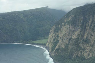
Hawaiian Valley.

  The Big Island has beautiful valleys.

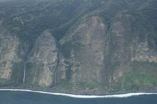
Kohala Cliffs and Waterfalls.

  It also has the Kohala cliffs which have waterfalls streaming down the side.

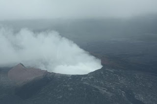
Steamin' Like A Demon.

  And of course it is home to the Kilauea volcano.  As we approached the crater we could see steam rising into the air.

Kilauea Volcano.
Captain Billy made sure we could get a good view.  We got closer to the mouth of the volcano.

Closer To The Volcano.

And even closer.

Flying Through Sulphuric Gas.

  And then closer still.   We could smell and almost taste the sulphur. The small plane was completely engulphed in sulphuric gas.  Looking out the window we could just see the propellers working to guide us through the thick smoke.

Captain Billy At The Controls.

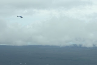
   Traffic ! Traffic ! went the warning in our headphones.  A small buzzer sounded.   Lights flashed on the control panel.  As we emerged from the smoke we realized we were not alone.  Several other helicopters and planes were bringing tourists to take a look down the throat of Kilauea.

Traffic ! Traffic !

  As our plane turned sharply to give us another view, the combination of gas and turning started to take its toll.  We started to sweat in our big noise cancelling headphones.   Traffic ! Traffic !  went another warning as we turned yet again.  We felt a bit queasy.  Many people including at least one of us are quite allergic to sulphur. 

Trees on Fire.
 So Hot You're Cool So Cool You're Hot.

  We moved away from the main plume coming out of the volcano and we started to feel a bit better.  On the edges of the volcano we could see flashes of bright orange lava along with the dark grey from lava that had cooled and formed a crust.   Some groups of trees were on fire as the volcano's lava flow took them in its grasp.  We were in awe of the destructive powers of the volcano.

Hotel Row Lahaina.

  Eventually we left the Big Island behind and it wasn't long before we were headed past the hotel row near Lahaina.  One smooth landing later and we were back on Maui.  Captain Billy gave us the shaka sign as we said goodbye and left him beside his plane on the runway.   He would probably be re-fueling and then doing it all over again.  We can always re-live it all over again in our memories as we watch the sun set across the Pacific.


Map of Our World
Kilauea Volcano
Maui Air (Kapalua Airport)

Post # 214

Monday 30 April 2018

Snowy Day At The Leslie Spit

Who You Looking At?

Location: Toronto, Ontario, Canada
Address:  1 Leslie Street
Date: April 2018
Website: www.tommythompsonpark.ca

  Snowy Owls are large white owls that spend most of their lives up in the Arctic.  They are usually found in Alaska and the territories of Canada.  We traveled to Churchill, Manitoba which is almost as far north as Nunavut and hoped that we might see one there.  We were not so lucky.  They breed even further north still, even as far as the top of Greenland.  In the winter they do come south and this is when you might see them in southern Ontario.  We had heard that some owls were out on the Leslie Spit in Tommy Thompson Park so we went to try and spot one.

Just A Tree Stump.

  It gets very cold out on the spit which juts out into Lake Ontario so most people don't get too far in the winter.  Snowy owls like the terrain out there as it reminds them of the Arctic tundra they usually call home.  Since snowy owls are almost completely white it is very hard to spot them in the snow.  It is still a difficult task even when the snow has gone.  This photo could have contained an owl but it is just a tree stump.

A White Bird On A Pole.

  Owls do like to perch on something where they can survey their territory.  In the photo above a seagull is doing the exact same thing an owl might do.  Sorry seagulls, but we already see you everywhere we go by the lake.

Dead Duck.

  On our first very cold outing we didn't see any owls.  We did see a poor duck who had possibly fallen prey to an owl, or one of the other raptors like a hawk or falcon that frequent the spit.

Ice Lines The Spit.

  On our second attempt we came across a photographer who had seen an owl up near the end of the spit.  We decided it was worth braving the cold to catch a glimpse of these beautiful birds.  It takes up to an hour to walk to the end of the spit and then the same time to get back again.  We made it all the way to the end but we didn't see any owls.  We suspect that the owls saw us.

Toronto Hides Behind The Islands..

  While we didn't get to see owls we did get a different view of Toronto.  At this point we were further into Lake Ontario than the Toronto Islands.   In this photo above you can see the Toronto skyline behind the Island trees.

Floating Bridge.

  The third time is the charm.  Once again we saw a photographer with a large, zoom camera.  We asked if they had seen anything exciting.  "There was a snowy owl" they said.   They kindly told us that they had seen it just beyond the floating bridge.  The floating bridge is usually a good spot to see swans, geese and ducks.

Swans, Geese and Ducks Are Not Snowy Owls.

Sorry swans, geese and ducks but today it is all about the owls.

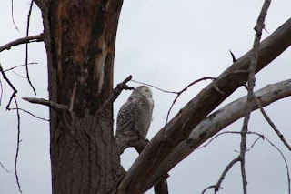
A Female Snowy Owl.

  Luck was with us as not too far past the bridge on a long, curved branch sat a female snowy owl.  Adult females have the dark barred pattern, while the adult males are almost completely white.

Snowy Owl On Its Perch.
 Snowy Owl Gives Us A Look.

  We spent a good deal of time watching the owl watching out across the spit.  Unfortunately, we are not designed to sit happily in the cold winds that blow across the lake and decided we must head back.

Owl In The Distance.

  We took one more look back at the owl.  You might be able to spot it in the two curved branches on the left of the tree above.

Toronto Is Spitting Distance Away.  Okay, Maybe A Bit Further.

  We were headed back to the warmth of the city.  Soon spring will be here and the owls will leave and head back to the cold of the Arctic.  Thanks for spending some time down here with us.


Map of Our World
Leslie Spit

Post # 213

Tuesday 20 March 2018

Montmorency Falls

La Chute Montmorency

Location: Quebec, Canada
Address:  5300 Boulevard Sainte-Anne
Date: Aug 2017
Website:  www.sepaq.com

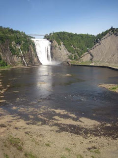
  Montmorency Falls is one of the highest waterfalls in Canada.  It is the highest waterfall east of Alberta.  After visiting Quebec City we stopped for a visit on our way to Tadoussac.  We took a cable car up to the falls then crossed over the falls on a bridge and then descended hundreds of steps back down on the other side.  This allowed us to go full circle around this impressive sight.

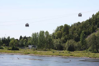
Montmorency From Cable Car.
Cable Car The Easier Way To The Top Of The Falls.

  We purchased our tickets which allowed us to park our car, ride the cable car and stroll the grounds surrounding the falls.  The cable car whisked us up to the top in no time at all.

Manoir Montmorency.

  After exiting the cable car we found ourselves at the base of the steps leading to Manoir Montmorency.

Hang In There Manoir.

  Manoir Montmorency is a restaurant situated next to the falls and clinging close to the edge of the cliff.  After passing the restaurant you take a walkway to a bridge that goes across the falls.

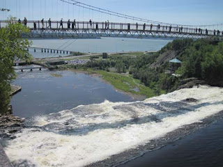
Careful Not To Let Anything Fall Into The Falls.

  This bridge is where you experience the true force of the water as it passes beneath you and drops 84 metres.

Montmorency River.

The water from the Montmorency River flows to the edge of the falls.

Hmmmm Drop.

  The water then prepares itself for the big drop as people admire it from above.

Drop.

Then it falls.

All The Way To The Bottom Maggie.

All the way down.

St. Lawrence River.

  The water then continues on its way into the St. Lawrence River.   The day we visited the water levels were quite low which makes us wonder what the falls would have been like after a big rainfall.

Quebec City In The Distance.

  After walking over the falls we crossed another smaller bridge and from the top of the hill we were treated to an excellent view of Quebec City.  Montmorency Falls are just a short drive north from the city.

No Not That Step, The One Above It.  That Step Felt A Little Loose.

  The next part of our journey took us down a series of steps built on grey slate rock.

Facing The Falls.

From the stairs you could get a great view facing the falls.

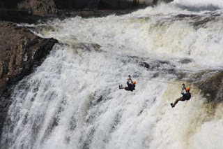
Tyrolienne

  You could also get a great view of the zipliners racing past the brink of the falls.  We had seen the zipliners picking out their helmets and building up their courage inside Manoir Montmorency earlier.

Over The Rainbow.

  As we looked down into the mist a rainbow formed.

Into The Mist.

  Finally we reached the bottom of the stairs and ventured onto a platform covered in the mist from the crashing water.  

Sugarloaf.

  In the winter this mist and spray forms what is called the Sugarloaf or Le Pain de Sucre.  It is created by the mist collecting and freezing to form a huge bump at the base of the falls. 

Full Circle Around Montmorency.

  We travelled along the edge of the grey slate slopes until we found ourselves back at the cable car station.  Our journey had now come fulll circle and we had admired the falls from every angle.


Map of Our World
Montmorency Falls

Post # 209