- -- - -- - -- - -- - -- - -- - -- - -- - -- -

Art--Animals--Dates--Food--Links--Lists--Map--Movies & TV--Music--Nature--Places--Performances--Souvenirs--Structures--Timeline
Showing posts with label Natural Beauty. Show all posts

Sunday 30 July 2017

Hopewell Rocks

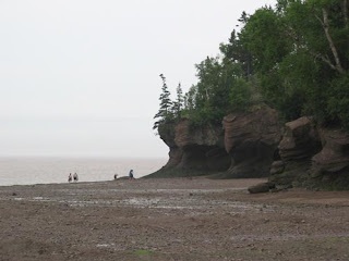
Hopewell Rocks Low Tide.

Location: Hopewell Cape, New Brunswick, Canada
Address:  131 Discovery Road
Date: July 2006
Website: www.thehopewellrocks.ca

    Hopewell Rocks in New Brunswick experience some of the highest tides in the world.  There is only a 6 hour gap between high and low tide. You can walk on the ocean floor during low tide and then come back later in the day and see the water fill back in.  You can see the difference between the two photos (above and below).

Hopewell Rocks High Tide.

The resulting erosion from the tides has created the unusually shaped flowerpot rocks.  These rocks experience higher erosion at their base and therefore appear to defy gravity.

Danger.

  Most recently in 2016 one of the more popular rock formations lost its battle with erosion and collapsed.  This is just how erosion works and eventually all of the rocks will lose their fight against the water.


The Tide Is High.
 The Water Has Retreated Again.

  The erosion is accelerated by these high tides.  Being immersed in water is not as damaging as having all that water push in and pull out again several times a day.


Seaweed Wall.

  When the tide goes out, seaweed clings to the rock waiting to be happily submerged in water yet again.

Through The Rocks.

  We visited the Hopewell Rocks on two different days in order to see both high and low tides.  There are tide timetables on their website that can help you plan your trip.

Everybody On The Floor.

  Most people want the experience of walking on the ocean floor when the tide is low.  Later you can see the same area where the water level would be up over your head.

Kayak Exploration.

   Some people rented kayaks in order to explore the rocks during hide tide.  If you have good eyes you may be able to spot a kayak on the right hand side of the photo above.


  We stayed in Moncton, New Brunswick where you can also experience the Tidal Bore.  The river was dry.  We then sat in the bleachers of Bore View Park and waited for the river to return.  Sure enough it started to make its way back along the riverbed.   It traveled sort of like how an overturned glass spills its contents across a counter top.  A tidal bore is the name for the little wave that is created as the water is pushed back up the river by the tides.  It has nothing to do with how exciting it is.  While not a particularly dramatic event, it is a great example of how gravity, the moon, the sun and the earth affect the water on our planet. 


We Hope All Is Well.

  The Bay of Fundy and the Hopewell Rocks area in general is a great spot to see what the tide brought in....and what it left behind.


Map of Our World
Hopewell Rocks Park , Bore View Park
Post # 184

Friday 30 June 2017

Canada Coast To Coast

  1. British Columbia
  2. Alberta
  3. Saskatchewan
  4. Manitoba
  5. Ontario
  6. Quebec
  7. New Brunswick
  8. Prince Edward Island
  9. Nova Scotia
  10. Newfoundland
  This year Canada is celebrating its 150th year of Confederation.  We are lucky enough to have seen the country from coast to coast.  We have been to all ten provinces and even touched the tidal waters of Nunavut from Churchill, Manitoba.  The territories are on our travel wish list.  Below is a list of just one of our favourite things from each province.

1 ) British Columbia
Afternoon Tea At The Empress.

BC has the animals, the Pacific Ocean and so much more. One of our favourite things was tea at The Empress Hotel in Victoria. Read More

2 ) Alberta
Banff Mountain View.

Alberta shares the Rocky Mountains with BC, but Alberta has Jasper, Banff and Lake Louise.  We fell in love with the snow capped mountains. Read More.

3 ) Saskatchewan
Roll On Saskatchewan.

Yes it is flat, but the fields with rolls of hay and the blue skies have a feel all their own.  It also seemed to have a never ending sunset as we drove westward. Read More

4 ) Manitoba
Churchill Polar Bear.

This is the furthest north we have ever been in Canada.  Our favourite thing in Manitoba is the polar bears of Churchill. Read More.

5 ) Ontario
Algonquin Getaway.

We spend most of our time in the province of Ontario.  Algonquin Park is our favourite place to really get away from it all. Read More.

6 ) Quebec
The Ice Hotel Bar.

Hotel de Glace is built each winter just outside of Quebec City.  We spent a night inside this palace of ice. Read More.

7 ) New Brunswick
Hopewell Rocks Low Tide.

The Hopewell Rocks are formed by the high tidal fluctuations that occur in the area.  You can walk down beneath the unusual rocks and 6 hours later the water has returned and filled everything back in. Read More.

8 ) Prince Edward Island
PEI's red soil.

Our brief two day visit to PEI was 48 hours of rain.  We did enjoy getting to and from the island.  First we drove across the marvel that is Confederation Bridge and then we saw the red soil when we left on a ferry.  We will return.  Read More.

9 ) Nova Scotia

Nova Scotia has Peggy's Cove and Cape Breton Island.  One of our best days in the province was spent at the Halifax Public Gardens. Read More.

10 ) Newfoundland
Iceberg Alley.

Iceberg Alley passes right around the top of Newfoundland.  We were lucky to see these gigantic 10,000 year old pieces of glacial ice as they floated in the Atlantic Ocean. Read More.

Ten provinces and ten wonderful memories.  
HAPPY 150th BIRTHDAY CANADA !!


Map of Our World
Banff Gondola , Saskatchewan , Hopewell Rocks Park , Halifax Public Gardens , Witless Bay
Empress Hotel , Hotel De Glace , Confederation Bridge
Tundra Buggy Tour , Algonquin Park (Lake Opeongo)

Post # 181

Saturday 20 May 2017

The Safety Dance

A place where they will never find.

Location: West Kington, England
Address: Drifton Hill
Date: September 2015
Website: www.menwithouthats.com

  "We can go where we want to. A place where they will never find."  It may seem like an unlikely place for Canadian band Men Without Hats to film their Safety Dance video, but thanks to some internet research and a very informative blog, we paid a visit to this special place.

S...H...E...E...P...Y  Sheepy Dance.

  West Kington is a small village that is located north of Bath and east of Bristol.  We were traveling along the M4 highway and had a plan mapped out before we left.  We made a few wrong turns but eventually reached our first sheep filled destination.

Cause your sheep don't dance and if they don't dance, well they're no sheep of mine.

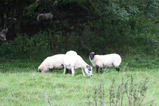
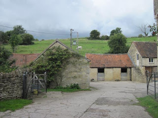
  Ebbdown Farm is in the background of the opening scenes of the video.  We don't recall seeing any sheep in the video, but when we visited they were everywhere.  If we walked close to a fence we would hear some baa-ing as they ran away on the other side.  The farm is located just a short drive from West Kington.

Sheep Without Hats.

  We drove our car up to a cattle guard at the gate of the farm.  Cattle guards also work at preventing sheep from crossing them as they have similar feet. Anyway, enough about the sheep let's get back to the video locations. 

We can dance.

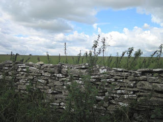
  The video starts off with lead singer Ivan running through a field with a little court jester.  They go past this wall and then run down to the road that leads to the farm.

We can act like we come from out of this world.

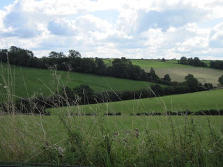
  It is here that they are joined by a dancing girl and come to a crossroads.  You can't see the other road as it is hidden behind the hill and tree, but they choose the one on the left.  The action then moves to West Kington.

Watersweet Post Box.

   The jester and girl dance along beside Ivan as he walks past some houses.  The home above still had the same red post box in front of it.

It's The Safety Dance.
Everybody look at your hands.

  Next we come across the gate where they do The Safety Dance.  The utility pole in the background helped us know that this was the place.  To do The Safety Dance you use both of your arms.  Your left arm goes right over your head and your right arm goes left across your waist in a jerky motion.  Now look at your hands.  If you are doing it right it will appear like you just formed an S.

We can leave your friends behind.  Or maybe they should come party with us.

  A crowd of people dressed in costumes head across the little bridge and march down the street.  They were all dressed real neat from their hats to their feet.  They would be heading towards the photographer in the photo above.

Everything's out of control.

  They all seem to be going to a May Day festival which takes place in the courtyard of this building.  There are people dressed as barnyard animals (but not sheep), there is a Punch & Judy puppet show and lots of dancing.  We can dance!

They're doing it from pole to pole.

  A group of people are dancing around a May pole as Ivan continues to sing.  The party continues for the rest of the video.  The Safety Dance came out in 1983 and was one of the more memorable videos and songs from the 80's.  Thirty years ago we were wondering what those strange people in the video were doing.  Today we know first hand exactly where they did it, but we still have no idea what The Safety Dance really is.  Oh well! They can dance if they want to.

And we can dance. It's the Safety Dance.


Map of Our World
Ebbdown Farm , West Kington

Post # 177

Friday 5 May 2017

The Tip of Point Pelee

Welcome To The Tip Of Canada.

Location: Leamington, Ontario, Canada
Address: 1118 Point Pelee Drive
Date: April 2017
Website: www.pc.gc.ca

  As Canada celebrates it's 150th year, admission to national parks is free with a Discovery Pass.  We decided that this was a good time for us to visit Point Pelee National Park.  It is a long, thin peninsula that reaches down into Lake Erie.  The tip of Point Pelee is the lowest point of mainland Canada. 

Five-Lined Skink on Tram.
Tip La Pointe.

  We were welcomed at the main gate of the park and headed south until we arrived at the Visitor Centre.  From the Visitor Centre we took a tram (above) which then transported us the next 2.5 km to the tip.

Having Fun...nel at Point Pelee.

  The first thing we encountered was an open air building with information about Point Pelee.  It explained that the peninsula is a migration funnel.  It literaly has a funnel shape and points from north to south into Lake Erie.  As a result it is the first piece of land that many migrating birds encounter after returning from their winter holiday.

Barn Swallow.

  It was only April, but the birds were already everywhere.  May marks the Festival of Birds and is when the majority of song birds arrive back in the park.  Inside the tip information building a few barn swallows had made their nests already and were flying back and forth over our heads.  Barn swallows like to build their nests in the top corners of buildings that have access so they can fly in and out.  The swallows in the information building arrived on the tip and made the first place they found their home.

South of the 42nd.

  We walked a little further and a big 42 appeared.  This sign was letting us know that we were just south of the 42nd parallel north.  Where we stood now we were on the same circle of lattitude as Rome, Italy or Barcelona, Spain.

East Beach of Point Pelee.


  We headed further south and took a pathway which led us to a beach.  We walked along this beach on the east side of the national park.

A Trip To The Tip.

  Finally we arrived at a pile of uprooted trees and rocks.  This was the tip. 


  There were a few birds floating just off the shore and swallows took turns swooping up and down near the water's edge.  We took a closer look and realized that we were surrounded by many species of birds.

Tree Swallows.

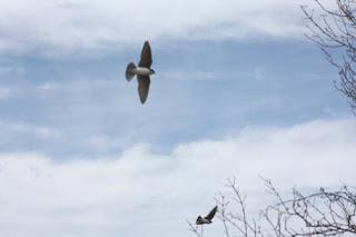
  There were the tree swallows eating bugs from just above the lake's surface.

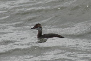
Horned Grebe.

There was a horned grebe.  Grebe have unusual feet because they have three lobed toes instead of the usual webbed feet of most other sea birds.

Bonaparte's Gull.

There was a Bonaparte's gull.

Red-Breasted Merganser Couple.

There was a Red-Breasted Merganser couple.

Swallow.

Lastly, there was this brown swallow who we have determined is either a juvenile swallow that does not have its colour yet or a northern rough-winged swallow.  Our best guess is northern rough-winged swallow.

Dutchman's Breeches.

After spending some time enjoying the birds and the view at the tip we took a different pathway back through a wooded area.  Along the way we noticed these unusual little white flowers.  They are called dutchman's breeches.  We guess this is because they look like little pairs of pants hung out to dry.

The Tip Line.

  As we reached the building where we waited for the tram we noticed a pay phone.  It stated that "You are at the tip".  We felt like calling someone and giving them this advice.  Here's a tip.  Why not make a point of visiting one of Canada's National Parks this year to celebrate Canada 150.


Map of Our World
Point Pelee (The Tip Exhibit)
Point Pelee (The Tip)

Post # 174